
Brooklyn Previous Residents Sources
A backward address trail changes as the era changes. ACRIS supplies the public online index for Brooklyn documents from 1966 forward. Older City Register material, BPL collections, maps, library shelves, and census schedules are the next routes. The table separates property evidence from a source that can place a historical name at an address. No source is a complete list of everyone who occupied a building.
| Source | Years It Covers | Where Held | What It Shows |
|---|---|---|---|
| ACRIS online | Brooklyn 1966 to present | NYC Finance City Register | Indexed documents, parties, parcels, recording data, and available images |
| City Register books and indexes | Approximate 1896 to 1966 bridge | City Register and microfilm route | Liber/page, block/lot, and grantor-grantee trail |
| Land Conveyance Collection | 1699 to 1896 | BPL Center for Brooklyn History | Block-organized transfer abstracts and older lot descriptions |
| Brooklyn Address Books | 1929–31, 1933–61, 1963–70, 1972–80, 1986 | BPL Center for Brooklyn History | Address-to-name evidence in the listed years |
| Federal and state census | Federal through 1950; state years vary | NARA, DORIS, archives, and library routes | Household snapshot at an enumeration date |
Start with the record nearest the period in question. A recent transfer points to ACRIS and PIP. An early house calls for the older property books, conveyance abstracts, maps, and directory runs. A census or address-book match needs the year, edition, page, and historical address preserved with it.
Brooklyn Past Residents Start
Begin with the current situs address, then convert it to the BBL, meaning borough, block, and lot. The NYC Property Information Portal accepts an address, Borough/Block/Lot, borough/block, condominium number, co-op development number, REUC identifier, air lot, and subterranean lot modes. Record the standardized street name, BBL, and, when supplied, the BIN. Save the parcel-card inspection date because display fields can change.
The PIP card may show owner, tax class, building and land characteristics, assessments, exemptions, sales summaries, mortgages, liens, and neighborhood geography. Treat it as a property lead. A blank value or a third-party mailing line does not prove that a parcel has no owner or that a person does not live there. The site address, or situs, is where the parcel lies. The mailing address is where bills or notices go.
Note: Keep the street spelling exactly as Geosupport returns it, because a repeatable starting address makes later document and map checks much easier.
Brooklyn Previous Residents Deed Chain
The City Register is Brooklyn’s recorder-equivalent, and ACRIS is its central index. Search the BBL in parcel mode, sort by recording date, and open each deed-like result. Capture the CRFN or document ID, document type, execution date, recording date, grantor, grantee, party addresses, legal description, and any referenced prior instrument. The records establish document roles and title evidence, not an automatic occupancy finding.
- Use PIP or ZoLa to confirm the current BBL and legal address.
- Search that Brooklyn BBL in ACRIS and identify the latest document that appears to transfer title.
- Read the grantor, meaning seller or transferring party, and the grantee, meaning buyer or receiving party, with the document dates and legal description.
- Search the grantor as a prior grantee, first on the same BBL and then by party name in Brooklyn.
- Test initials, punctuation, married or former names, estate wording, trusts, and entity suffixes. Check nearby dates because execution, recording, and indexing dates can differ.
- Stop for a map check when the older deed uses a different number or lot. Then repeat with the supported legal description.
- Grantor and grantee
- The grantor transfers an interest. The grantee receives it. The roles are tied to one document and do not establish residence.
- Chain of title
- A dated sequence of recorded transfers for the same property, checked for later deeds, corrections, and related instruments.
- Legal description
- The lot, block, condominium, or other parcel wording that identifies property more precisely than a street line alone.
- CRFN
- The City Register document reference used to locate and verify an ACRIS filing.
Correction deeds, transfers to an estate, and transfers involving an entity can change the next name to search. A same-name party match needs the BBL or legal-description connection before it belongs in a house timeline.
Brooklyn Past Residents Before ACRIS
ACRIS has a hard online boundary at 1966 for Brooklyn real-property documents. When that boundary is reached, change repositories rather than assuming the trail ended. BPL’s house-history guidance points researchers to older City Register block and lot indexes, property books, liber/page references, and microfilm. The City Register and the relevant reading-room or counter route remain part of the research path for older documents.
The Center for Brooklyn History’s Brooklyn Land Conveyance Collection is especially useful because its block-organized abstracts reach from 1699 to 1896. They name grantor and grantee and preserve older lot descriptions. They are abstracts, not the original deed and not a certified title record. Pair an abstract with City Register books, NYPL indexes, or the original document route when the conclusion depends on the wording of a transfer.
This 1966-to-1699 contrast is the important Brooklyn records story: online ACRIS provides a modern index, while BPL’s older abstract collection supplies a separate deep historical layer. The gap requires a change in method, not an invented claim that earlier records disappeared.
Brooklyn Past Residents House History
The BPL house and building history guide joins address changes, atlases, insurance maps, conveyance abstracts, City Register books, tax maps, directories, DOB material, tax photographs, probate, and Green-Wood research. It is a Brooklyn-specific checklist. It also warns that many addresses changed around 1871–72, a date that matters whenever a current number fails in a nineteenth-century directory or deed index.
The BPL house-history guide provides the local research route shown in the image.
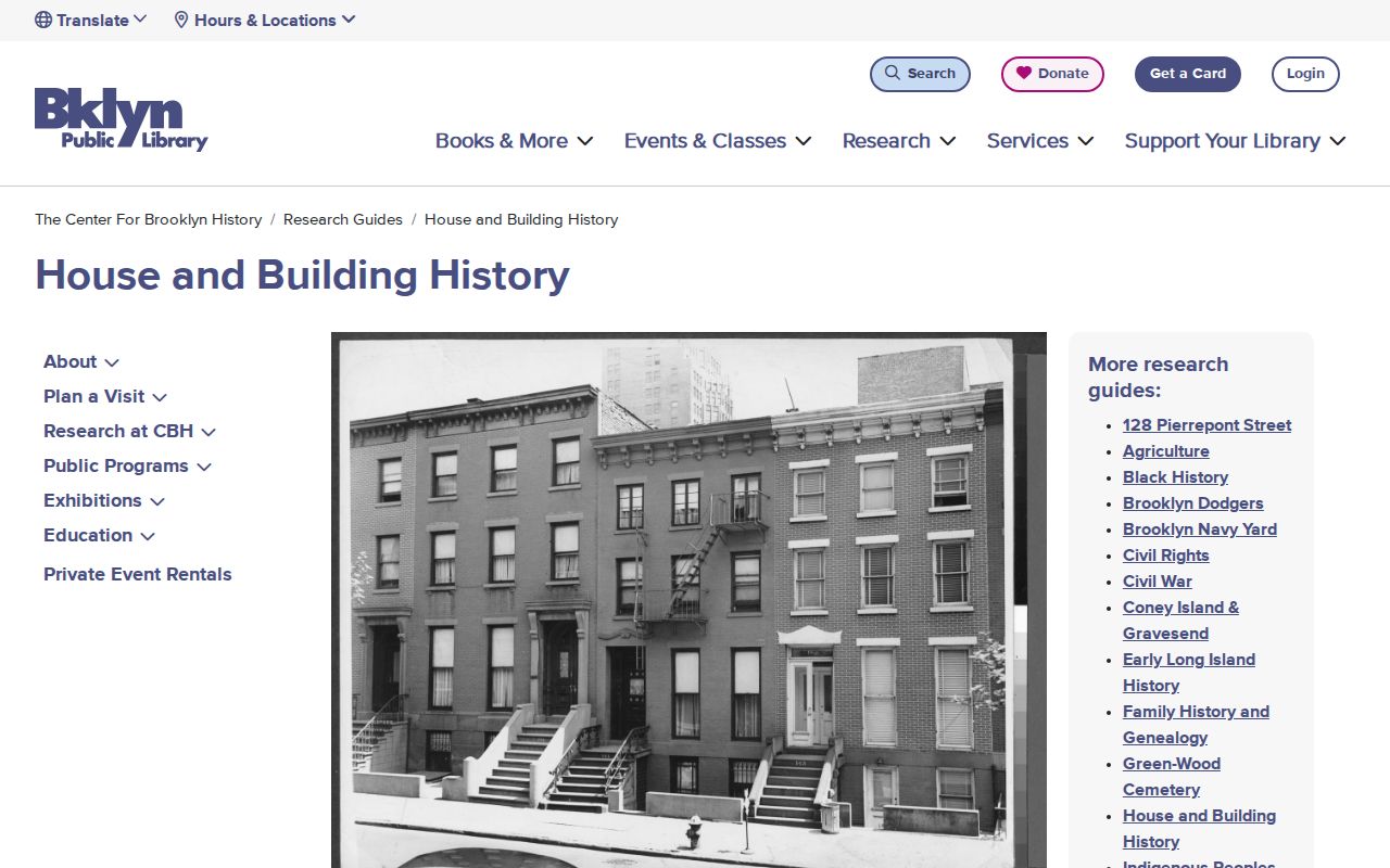
Use the guide as a sequence of evidence checks. A map may show a lot footprint, a tax photograph may show the exterior, and a permit may date construction or alteration. An applicant, architect, or licensee on a building filing has a project role, not a proven household connection.
Brooklyn Previous Residents in Directories
Property transfers are only one trail. Brooklyn Address Books, also called criss-cross directories, can put a historical name at an address in their published runs: 1929–31, 1933–61, 1963–70, 1972–80, and 1986. Elite directories cover 1873–1913 and Blue Books cover 1904–1962, with address material in their own formats. Standard directories are mainly alphabetical, so an address search may require a street section or reverse volume.
For each entry, preserve the volume title, publisher, year, page, name spelling, printed address, occupation or business address, and any notation. An address can be a business location in a classified work. Older alphabetical collections often emphasized a head of household, and women can be underrepresented. These limits belong beside the result, especially when trying to determine who lived here before.
The historical holdings are treated in depth in the Brooklyn city directory. Here they serve as dated household evidence within an address trail. Missing criss-cross years are real collection gaps, not proof that a building stood empty.
Brooklyn Past Residents and Censuses
Pair a directory year with the closest federal or New York State census. Federal schedules through 1950 are available under the 72-year rule, with 1950 released in 2022. The state-census years relevant to Kings County are 1855, 1865, 1875, 1892, 1905, and 1915. DORIS describes those state holdings as not name-indexed, so ward, assembly district, or enumeration district work may be needed.
- Normalize the historic street name and number before beginning the census search.
- Record the directory citation and locate the nearest census year.
- Use the address, ward, cross streets, and map evidence to identify the likely enumeration area.
- Compare names, ages, relationships, nativity, and occupation with the directory entry.
- Use a newspaper, obituary, probate file, or deed only as corroboration of the same person and date.
Census evidence is a dated household snapshot, not an unbroken address history. Street numbers can be missing or abbreviated, and the 1871–72 Brooklyn numbering change can require an atlas or tax-map bridge. Record the original address rather than silently converting it to a modern one.
Brooklyn Past Residents Endpoints
Maps and later-life records help test a timeline. The Library of Congress Sanborn finder covers Brooklyn volumes from 1886 to 1973, and BPL’s Fire Insurance Maps Online supplies access with a library card. A map records footprint, construction, stories, use, and lot context, not a resident name. Compare the map date, volume, sheet, adjacent lots, and street widths before treating two addresses as the same structure.
NYC’s 1940s tax photographs provide an address-searchable exterior snapshot from about 1939–41. Probate and obituaries can close a former-resident trail when an estate file names an executor, heirs, residence, or property reference. Green-Wood burial data and a newspaper notice can support a date, but need corroboration when a surname is common. Kings Surrogate records and the relevant court file remain the stronger source for estate details.
Brooklyn Previous Residents Address Changes
Brooklyn became part of Greater New York in 1898, while Kings County became coterminous with the borough. Older material can therefore use Flatbush, Gravesend, New Utrecht, Flatlands, New Lots, or City of Brooklyn language. Address changes around 1871–72 add another layer. Search alternative numbers, street spellings, ward or town names, lot dimensions, and the legal description before rejecting an older result.
A strong address timeline includes the modern address, historic variants, BBL or BIN, document ID and dates, grantor and grantee, legal-lot description, directory citation, census district, map volume and sheet, permit or job number, probate file, and source route. That record-by-record approach keeps past residents and named document parties in their proper context.
Note: A carefully cited gap is more useful than a confident claim based on a name, a mailing line, or an unverified map match.