
Trace a Brooklyn Street by Address
A full Brooklyn street segment is assembled one parcel at a time. PIP does not publish a universal browse list for a named street, so begin with a known address or use map and address-point tools to standardize the segment. Geosupport and map tools can return the street form, cross streets, ZIP, BBL, BIN, and geography. The BBL is then the bridge to a Finance parcel card, ACRIS documents, and building systems. This is an address-record workflow, not a claim that a map labels all people on a block.
Each record answers a narrow question. Finance may show an owner or entity. ACRIS can show recorded grantors, grantees, and document addresses. DOB or HPD can identify a filing, owner, managing agent, applicant, or licensee role. A dated reverse directory can put a historical name at an address for its published year. Cross-check the street number, BBL, date, and role before linking any entries.
- Normalize the Brooklyn address in PIP, Geosupport, ZoLa, or NYCityMap and record its BBL and BIN where returned.
- Open the PIP parcel card for owner or entity, property facts, and the Finance record date.
- Search the BBL in ACRIS and inspect the latest deed-like filing, its parties, dates, CRFN, and legal description.
- Check DOB BIS, DOB NOW, and HPD by address, BBL, or BIN for public building and filing evidence.
- For earlier periods, compare a criss-cross address book, map, census, or archive entry with the printed address and year.
Brooklyn Street Directory Property Cards
The NYC Property Information Portal is a parcel search tool. It accepts an address, intersection, or common place, as well as Borough/Block/Lot and Borough/Block paths. Other modes cover condominium number, co-op development number, REUC identification, open tax account, air lot, and subterranean lot. The form is not designed as a primary owner-name lookup. A whole-street project therefore moves from standardized addresses to individual BBL cards instead of treating the portal as a people list.
The NYC Finance Property Information Portal shows the address and parcel entry options used for Brooklyn address research.
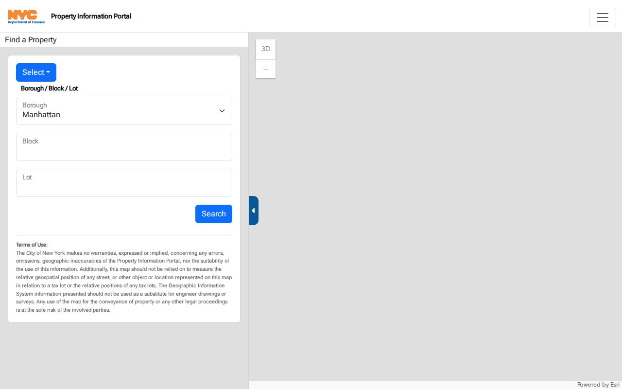
The separate address, BBL, condo, co-op, and special-lot paths help explain why the same apparent street address may lead to more than one parcel record.
| PIP field or mode | Required input | Street-search use |
|---|---|---|
| Address | Street number and name | Find a parcel from a known location, intersection, or common place |
| Borough, Block, Lot | Borough selector, numeric block and lot | Open a parcel already identified in a document or map |
| Borough and Block | Borough selector and numeric block | Work within a block before choosing a lot |
| Condominium or co-op | Borough and development identifier | Handle property arrangements outside a simple lot pattern |
| Air or subterranean lot | Borough, block, and special lot number | Locate a related special parcel record |
Brooklyn Parcel Fields and Meanings
A PIP parcel card can show owner, type, tax class, building counts, year, stories, area, units, land characteristics, assessments, exemptions, recent sales, recent mortgages or liens, and neighborhood fields. Its recent recording summaries are informational. A title or complete-record question belongs in ACRIS. Blank values and stale entries are possible, so save the card link and the inspection date rather than assuming the display is a final answer.
A NYC Finance parcel-card display shows the range of building, land, assessment, and recording-summary information linked to a property.
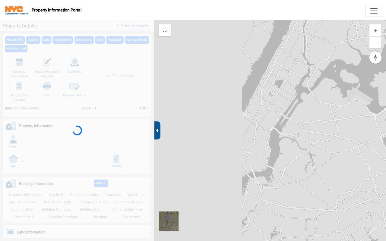
The card supplies parcel context for a street search, while ACRIS remains the official place to inspect a recorded instrument.
- Parcel
- A mapped lot or property unit identified for tax and record purposes.
- Situs address
- The physical location attached to the parcel and BBL.
- Mailing address
- The line used for bills or notices, which can belong to an entity, agent, attorney, or location away from the parcel.
- Plat
- A recorded map or plan that helps identify a parcel and its legal configuration.
- Criss-cross directory
- A reverse address book that lists a name by address for a particular published year.
Map Brooklyn Streets to BBLs
ZoLa, NYCityMap, Geosupport, and NYC Address Points turn a street reference into map and geography data. Geosupport has address, intersection, BIN, BBL, street-name, blockface, and neighborhood functions. Depending on the function, it can return standardized street names and codes, cross streets, ZIP, community district, census tract, police precinct, coordinates, and other geographic values. The map layers may also show parcels, zoning, historic districts, and district boundaries.
For a segment, record the cross streets and each BBL before opening property sources. Click parcels rather than assuming adjacent doorway numbers are one lot. A condominium, cooperative, air lot, subterranean lot, or multi-building parcel can have several related records. Planning map products are useful research tools, but they are not a legal survey. Note: A street can cross ZIP and community-board boundaries while the parcel identifiers remain the steadier record keys.
Brooklyn Mailing and Situs Addresses
The situs address is where the parcel is located. The mailing address is where Finance sends bills or notices. Those are not interchangeable. A mailing line can point to an owner, attorney, managing agent, bank, trust, estate, or business entity outside Brooklyn. An owner field may also identify an LLC, a cooperative corporation, or another legal structure instead of a human name. The line is a lead for a property record, never automatic proof of current occupancy.
When a human-name trail is needed, compare the deed image and party addresses with probate, a business filing, and a dated directory entry. A result becomes stronger when the BBL, legal description, date, and source role agree. The comparison prevents street research from turning a tax mailing destination into a claim about a household.
Brooklyn Street Directory Deed Chains
ACRIS searches Brooklyn recorded property documents online from 1966 forward. Search a BBL for the parcel’s indexed filings, then open the latest deed-like document and read its grantor, grantee, execution date, recording date, CRFN or document ID, parcel description, and references. A recorded grantee may be a current owner only after later deeds, corrections, transfers, and related filings have been considered. ACRIS does not identify every person who uses the building.
For a backward chain, use the seller or grantor from one deed as a prior grantee search and compare the same BBL and nearby dates. Try initials, punctuation, married or prior names, estate wording, trust wording, and entity variations. When the index reaches the 1966 boundary, move to City Register books, liber and page indexes, microfilm, NYPL indexes, and BPL’s block-organized Brooklyn Land Conveyance Collection.
ACRIS is the City Register’s official entry point for Brooklyn parcel and party document searches.
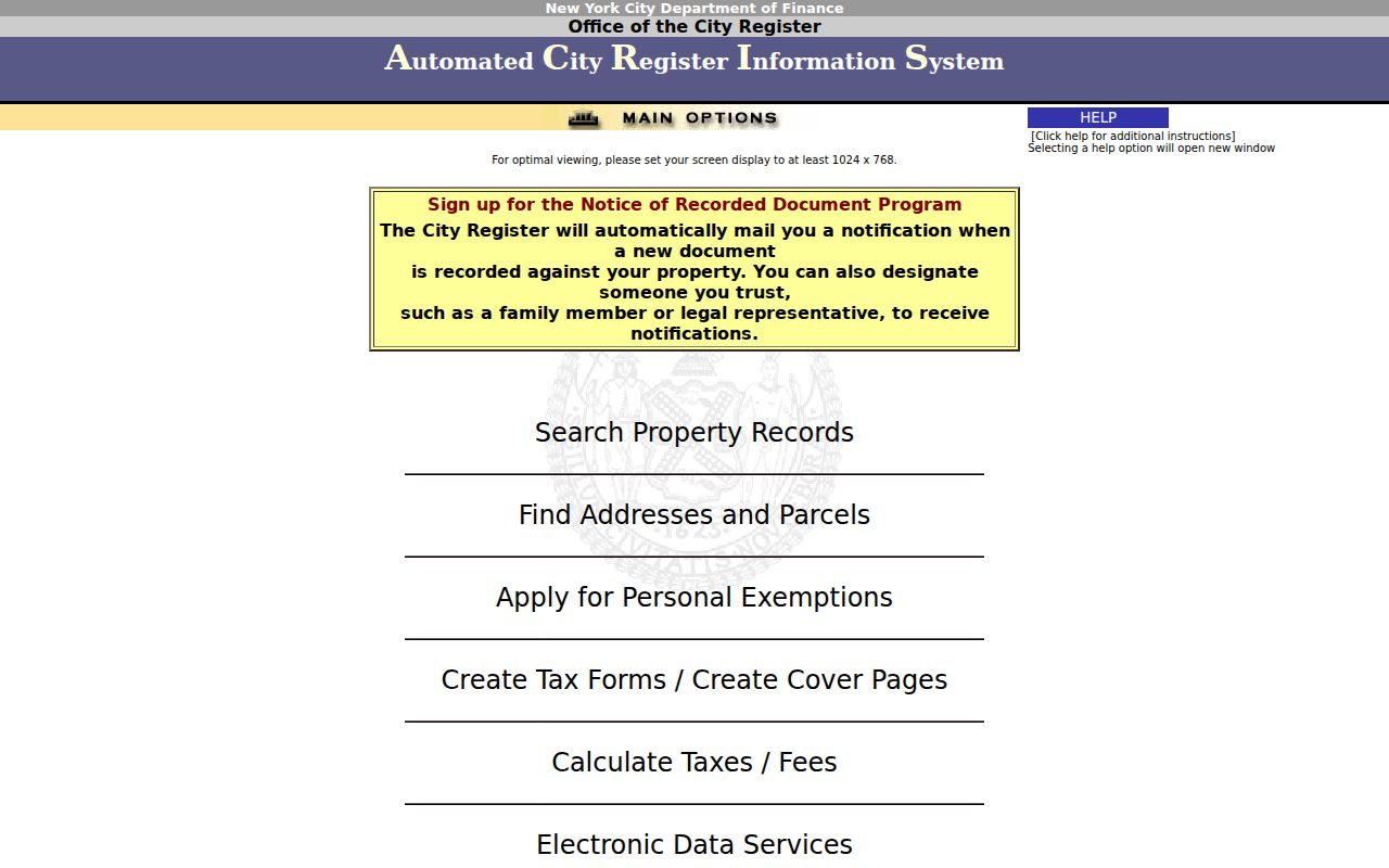
The documented search choices show the BBL, party-name, and document-reference routes that turn a street address into a recorded-property trail.
Brooklyn Address Record Coverage
Address-keyed sources are strongest when their limits remain visible. The table separates property, recorded-document, building, voter, historical-directory, and map layers rather than collapsing them into a single answer about a street. A source may show a location, a filing party, or a dated historical entry without identifying every person in the building.
| Brooklyn address source | What it can show | Access route | Key limit |
|---|---|---|---|
| PIP parcel card | Owner or entity, BBL, tax and building facts | NYC Finance portal | Not a complete household roll |
| ACRIS | Recorded parties, dates, documents, legal parcel data | City Register index and image route | Not every occupant or a title opinion |
| DOB and HPD | Permits, filings, complaints, registrations, violations | Address, BBL, or BIN searches | A record role is not occupancy proof |
| Board of Elections matcher | Exact-person registration match | Five-field online form | No public street or block browse |
| Criss-cross address books | Historical address-to-name entry | BPL and CBH collection route | Only covered years, not a complete household record |
| Atlases and tax photos | Footprint, lot, use, and physical context | DORIS, BPL, and Library of Congress | No resident identity |
For present street work, map one BBL at a time. For historical work, save the directory title, publisher, year, page, printed street form, and any old number. The Brooklyn city directory page provides the library shelf detail for the historical volumes.
Brooklyn Building Record Layers
DOB BIS and DOB NOW are complementary public systems. BIS searches can use address, BBL, BIN, job number, device, licensee, and violation information. DOB NOW holds newer filing categories, while some BIS-only material must be checked through Building on My Block. Its address form uses house number, street name, and borough. Results can connect a building to a job number, filing action, inspection or request number, status, permit, and filing role.
HPD Online adds address or BBL records for complaints, violations, property registration, charges or litigation, and vacate orders. These are building records. A name can identify an owner, agent, applicant, or licensee in relation to a filing, but it does not establish that the named person lives there. Search both DOB systems when a result is missing, then keep the address, BIN, BBL, date, and role with any note.
Brooklyn Reverse Address Books
Brooklyn address books are the historical reverse-directory layer. Center for Brooklyn History holdings cover 1929 to 1931, 1933 to 1961, 1963 to 1970, 1972 to 1980, and 1986. Elite directories are address-organized for 1873 to 1913, while Blue Books for 1904 to 1962 use back-of-book address searching. Standard directories are more often alphabetical, so an address search can require a street section or a reverse title rather than a name index.
These books are dated evidence, not a current address directory. They have explicit gaps, and older editions may favor heads of household or selective social listings. Capture the title, year, page, spelling, address, and any notation. For one person who needs confirmation across several record types, use the more focused Brooklyn resident lookup workflow.
Brooklyn 1871 Address Numbering Change
Many Brooklyn addresses changed around 1871 and 1872. That is a practical trap when an old directory, deed abstract, atlas, or newspaper seems to point to a different place than a current map. Before rejecting an entry, compare alternate street spellings, historic and current numbers, cross streets, ward or town references, lot dimensions, and map sheets. A later BBL may represent a subdivision or consolidation of earlier lots.
The BPL house-and-building research guidance links address changes with atlases, insurance maps, conveyance abstracts, City Register books, tax maps, directories, permits, and 1940s tax photographs. The 1871 to 1872 change is a Brooklyn-specific reason to carry a date column through every address search. Note: A matching street name is not enough when the street number or lot boundary has shifted.
Brooklyn Address Record History Gaps
Brooklyn’s address record chain changes by era. ACRIS begins online in 1966, while older City Register books and microfilm form an approximate bridge from 1896 to 1966. The Brooklyn Land Conveyance Collection has block-organized transfer abstracts from 1699 to 1896. Historical directories, maps, state census material, probate, newspapers, and tax photographs fill different parts of the earlier trail. Their overlap is valuable, but no one source makes a complete list of every former household.
Use the record’s own date and kind when comparing it. A land abstract is not a deed, a map is not a resident list, and a parcel owner is not always an occupant. The 1898 consolidation also means a nineteenth-century source may use City of Brooklyn or a former town name such as Flatbush, Gravesend, New Utrecht, Flatlands, or New Lots. Search the historical jurisdiction as well as the modern borough.
Brooklyn Street Voter Search Limits
The NYC Registered Voter Search requires first name, last name, birth date, borough, and ZIP. It checks an individual match or returns record not found. It does not let a user browse everyone on a street or block. The statewide voter-file route is a separate request that requires an elections-purpose statement under Election Law §3-103(5). Protected and confidential voters also require special handling.
For historical poll or voter material, no digitized name-searchable Brooklyn poll-book database was located in the research. The documented fallback is a targeted request for an existing record by year, ward, election district, or borough, plus DORIS and BPL historical sources. Do not request a newly compiled address list, and do not treat a registration match as a record of how someone voted.
Brooklyn Address Record Privacy Limits
A street search cannot reveal a universal household list. Public parcel and filing systems have defined record roles. DMV address data is protected by the Driver’s Privacy Protection Act, and utility or delivery customer lists are not ordinary public sources. The New York Address Confidentiality Program uses substitute-address protections for eligible participants, while confidential voters are not an ordinary address-search category. A missing result can reflect scope, timing, spelling, or protection rather than the absence of a person.
Use public address records for personal, family-history, property, and civic research only. When a record is restricted, follow the custodian’s legal request channel instead of trying to reconstruct protected information from nearby records or mailing fields.