
Brooklyn ZIP Code Coverage
Brooklyn has ordinary delivery ZIPs as well as special, institutional, PO-box, and high-volume codes. The USPS Brooklyn grouping notice places many codes in broad operational groups, but those groups are postal context rather than official neighborhood borders. This table centers common geographic delivery areas. Test an edge address in the current USPS tool before limiting a public-record search by ZIP.
| ZIP | Areas Covered | Post Office | Notes |
|---|---|---|---|
| 11201 | Brooklyn Heights, Downtown Brooklyn, DUMBO, Cobble Hill | Brooklyn main postal operation | Northwest Brooklyn group |
| 11205 | Fort Greene, Clinton Hill, parts of Bedford-Stuyvesant | Northwest Brooklyn group | Not a city-limit boundary |
| 11211 | Williamsburg, parts of Greenpoint | Williamsburg Station | Part of its area shifted in 2011 |
| 11215 | Park Slope, Gowanus, Windsor Terrace | Northwest Brooklyn group | Touches several neighborhood labels |
| 11226 | Flatbush, Midwood, Kensington, East Flatbush | Flatbush group | Large ZIP with several neighborhoods |
| 11234 | Canarsie, Flatlands, Bergen Beach, Mill Basin | Canarsie/Flatlands group | Southeastern Brooklyn |
| 11235 | Brighton Beach, Sheepshead Bay, Manhattan Beach, Gerritsen Beach | Southern Brooklyn group | Coastal and peninsula areas |
| 11249 | Williamsburg waterfront and new delivery area | Williamsburg Station | Created July 1, 2011 |
Other ordinary codes cover Bay Ridge, Sunset Park, Bushwick, Greenpoint, Coney Island, Crown Heights, East New York, and Sheepshead Bay. Codes 11202, 11240 through 11248, and several later special codes are described in the research as PO-box, institutional, or high-volume functions rather than ordinary neighborhood geography. This postal index is a location aid, not a household list.
Brooklyn ZIP Code Postal Groups
USPS places 11201, 11205, 11215, 11217, and 11231 with Northwest Brooklyn. It groups 11209, 11214, and 11228 with Southwest Brooklyn; 11212, 11213, 11216, 11233, and 11238 with Central Brooklyn; and 11206, 11221, 11237, 11211, 11222, and 11249 with Bushwick, Williamsburg, and Greenpoint. Southern and coastal areas include 11223, 11224, 11229, and 11235. These useful labels do not replace the legal parcel key.
A ZIP can cross community-board lines and a neighborhood can have more than one postal label. The research notes overlaps for 11219 and 11221. Keep the full street address, BBL, and community district with the ZIP when comparing a property document, map result, or historical record. That combination reduces false matches where a Brooklyn neighborhood name appears in several systems.
Note: A postal preferred-city name and a Brooklyn neighborhood name can both be familiar, yet neither substitutes for the parcel description in a recorded document.
Brooklyn ZIP Code 11249 Split
One clear geography change affects Williamsburg. The USPS notice for the 11249 change says the new ZIP began on July 1, 2011. It revised part of the 11211 delivery area, with the notice describing 16,046 affected delivery customers and 11,455 moved from 11211. Older correspondence, directories, or saved records can therefore carry 11211 even when a current address lookup returns 11249.
USPS documented the Williamsburg delivery adjustment before the image below was captured.
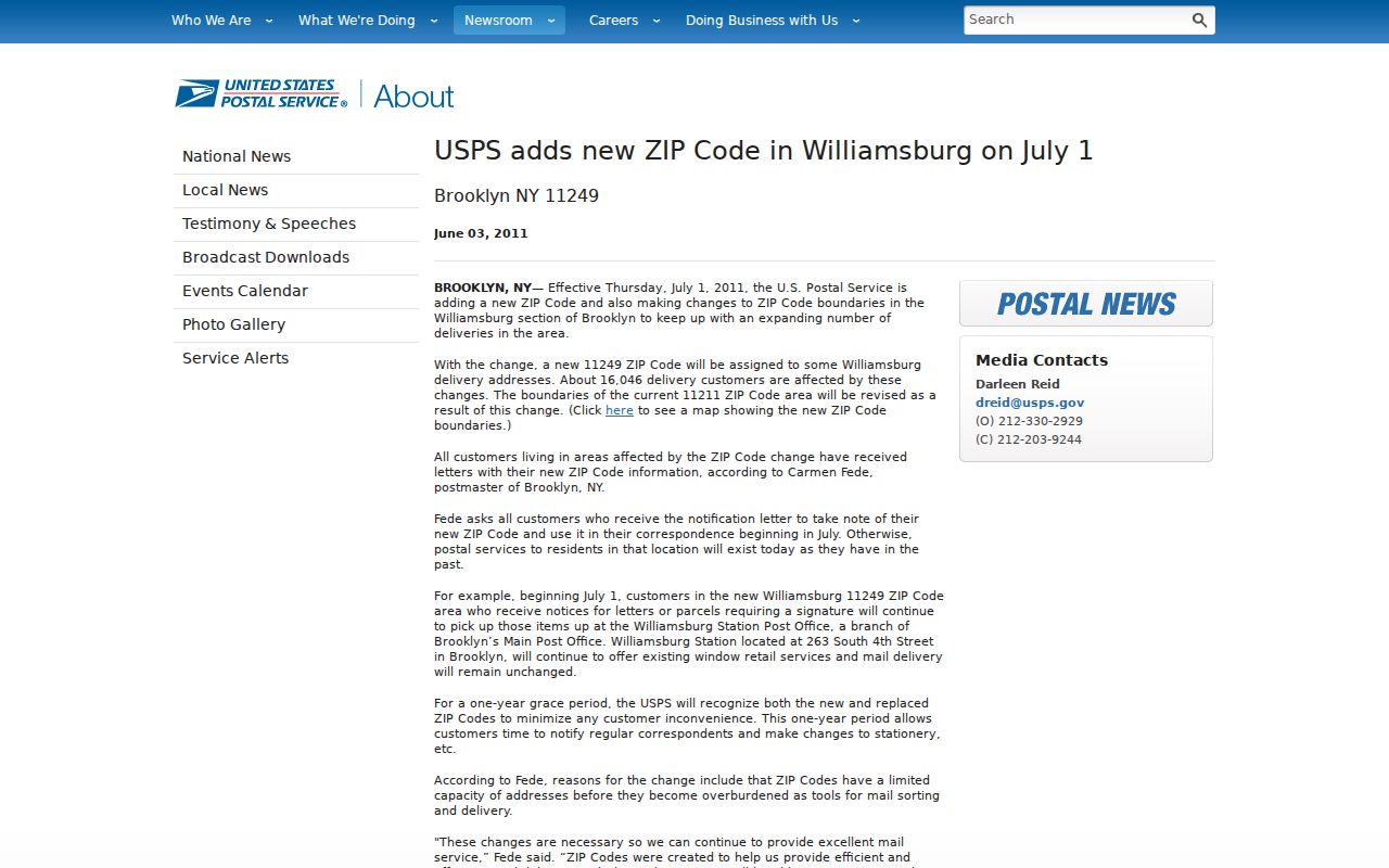
The notice is a date marker for a postal assignment. It does not change the BBL, a recorded legal description, or deed custody. When a record spans the change, save both the historic code and the USPS-verified current code.
Brooklyn ZIP Code Search Steps
Finding a name or record within one ZIP requires a source-specific route. The public NYC voter matcher is not a ZIP-wide directory. It requires first name, last name, birth date, borough, and ZIP, then returns a registration match or a non-match. Finance property records are driven by address or BBL rather than a boroughwide ZIP browse. Start with postal verification, then move to the custodian that holds the actual question.
- Use the USPS ZIP Code Lookup with the full Brooklyn street address to verify the current delivery assignment.
- Enter the address in the NYC Property Information Portal and capture the BBL, BIN when returned, and situs address.
- Use the BBL in ACRIS for recorded property documents, or use exact identity fields in the Board of Elections matcher for one registration-status check.
- Keep a date beside every ZIP result, especially for an older address, a changed number, or the Williamsburg area affected by the split.
A ZIP narrowing is often the first filter, not the conclusion. Once the address is known, the Brooklyn street directory gives the fuller address-to-parcel route without treating a postal area as a household roster.
Brooklyn ZIP Code Search Fields
Official tools apply ZIP differently. NYC Board of Elections uses it as a required identity field, while state license and public-registry tools can use it as a narrowing option. NYC Address Points contains a ZIPCODE field, but the durable record path remains an exact address, BIN, or BBL. These field choices come from the inspected public search routes.
| Portal | ZIP Use | Other Needed Fields | Result Boundary |
|---|---|---|---|
| NYC voter match | Required five-digit ZIP | First name, last name, birth date, borough | Match or non-match, not a ZIP-wide browse |
| NYS Licensee Search | Optional narrow | Name or business name, license type, city or county | Active-license information |
| DCJS public subdirectory | One search mode | ZIP rather than name or county mode | Public Level 2 and 3 listings only |
| NYC Address Points | ZIPCODE attribute | Exact address, BIN, BBL, or map data | Address normalization, not identity |
| NYC PIP | Returned with property context | Address or BBL modes | Parcel information, not a ZIP browse |
New York voter-file access uses another channel. The statewide request process requires an elections-purpose statement under Election Law §3-103(5), and protected or confidential voters cannot be treated as ordinary address data. A request should identify an existing file and its geography or date rather than ask an agency to build a new resident list.
Brooklyn Postal Boundaries
Brooklyn is coterminous with Kings County, yet its ZIPs do not act like city limits or municipal boundaries. They are delivery areas. A mailing ZIP on a parcel card can differ from the situs ZIP because an owner, agent, or other billing recipient receives notices elsewhere. PIP’s primary key is address or BBL, and the official recorded trail is held through the City Register, not the post office.
- ZIP versus ZIP+4
- The five-digit ZIP identifies a delivery area. The extra four digits refine delivery for a smaller segment or address range.
- PO-box ZIP
- A code for post-office boxes or postal operations, rather than ordinary street-delivery geography.
- Unique ZIP
- A code associated with high-volume, institutional, or special postal use. It should not be assumed to describe a neighborhood.
- Carrier route
- A mail-delivery sequence. It is not a legal parcel boundary or a resident roll.
Brooklyn’s citywide record systems make the distinction important. Use a ZIP to test a delivery address, then use Geosupport, Address Points, PIP, or ZoLa to obtain parcel and civic attributes. A BBL remains more stable than a ZIP when researching a recorded deed or comparing map eras.
Brooklyn Postal Areas and BBLs
Postal geography answers where mail is delivered. The BBL, meaning borough, block, and lot, identifies the tax parcel. Geosupport can return a standardized address, cross streets, ZIP, community district, and BBL. PIP uses the BBL across property records, and ACRIS uses it for parcel searches. A condominium, air lot, subterranean lot, or cooperative can complicate the relationship, so one building address may not map to one simple parcel record.
This comparison matters when a postal directory points to a large area. A record that names a Brooklyn ZIP might only indicate a mailing area. A deed’s legal description and BBL provide the better bridge to an earlier lot, a correction deed, or a current property card. Do not treat the owner or mailing address in a property system as proof of current occupancy.
Brooklyn Postal Geography
Brooklyn’s scale makes a ZIP label broad. USPS identifies northern waterfront, central, southwest, coastal, Canarsie/Flatlands, Borough Park, and Bushwick/Williamsburg/Greenpoint groupings. Community-board and planning boundaries cut across delivery areas. Preserve the neighborhood wording used by a source, but verify the address through the parcel map before connecting it to a civic district or a historical town name.
For pre-1898 material, a record may use Flatbush, Flatlands, Gravesend, New Lots, or New Utrecht instead of Brooklyn. Many addresses also changed around 1871–72. Postal geography does not solve those earlier problems. Historic maps, lot descriptions, alternate street numbers, and the recorded parcel trail provide the bridge. The City’s map products are informational and are not a legal survey.
Use the postal result as one field in a research note, not as the heading for the whole file. Record the address entered, the verification date, the returned delivery area, and the source that supplied the surrounding geographic context. If the next search is a property question, retain the BBL. If it is a historical address question, retain the older number, street spelling, ward or town label, and the map sheet. This small amount of context is what makes an address result repeatable when postal assignments or online displays later change.
Geosupport adds cross streets, community district, census tract, and other geographic attributes to an address result. Those Brooklyn fields help distinguish postal service geography from the parcel and civic boundaries used by records custodians.
Note: ZIP filtering can save time, but it cannot replace an exact-address review when the result concerns a historic household, a recorded owner, or a protected person.
That recordkeeping also makes later verification clearer.